Sunday, May 11, 2008
Lincoln Rock State Park, Wenatchee WA
The park is located just above Rocky Reach Dam which is one of three on the Columbia that are owned by Chelan County Public Utility District. Well, one of them is at the outlet of Lake Chelan so technically it isn't on the Columbia, but it is pretty close. We toured the dam and will have some interesting photos from there that I'll get to in another post.

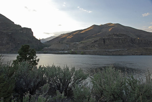
This first photo will show you a bit about how the terrain looks over there in this part of Eastern Washington. It was truly desert before irrigation water was added. I think the only trees were planted although some along the river shores have probably developed on their own. One really neat thing about most of the State Park campgrounds is that they have lots of space, so the sites are not squeezed in real close together like most in commercial campgrounds seem to be.

That first photo was taken in front of our campsite and this one is from the same place but looking in the opposite direction. This is in the full hookup area of the park so it mostly RVs as tenters don't need all the hookups and usually go into a lower priced area especially for them.

This was our space #48, with our motorhome and Saturn toad (tow car) parked there. You can see how much space there is inside the loop road that goes around the campground by looking behind our rig. That other RV that is behind the tree is quite a ways away.

This pathway goes downhill from the full hookup sites to the tenting area and the improved shoreline. There are docks there to tie your boat up to although there were no boats there when we were there. Wait until summer! There are more trees in the tenting area, probably to provide shade as it regularly gets over 100 degrees in this part of the state in the summer, and most tents do not have air conditioners.

This is a view looking west across the Columbia River. I really like the way the sun is hitting those hills over there, shortly before sunset time. The roadway on the other side is US-97A (alternate) while the regular US-97 is on our side. Later they join farther upriver and it is just US-97 that continues north.

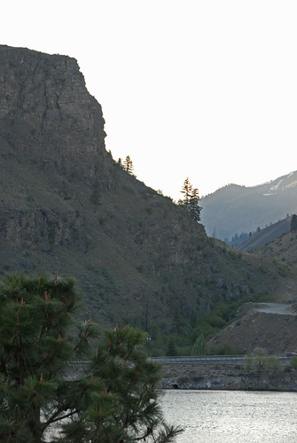
This is looking at the same area but with a longer lens. The rock that this park was named for is in this view and was named back in the 1800s by some of the original settlers who felt that part of the rock over there resembled a profile view of Abraham Lincoln.

This is an even closer view of the head of Lincoln. It is a bit of a stretch to see it but I am able to visualize the resemblance and think you can, too.

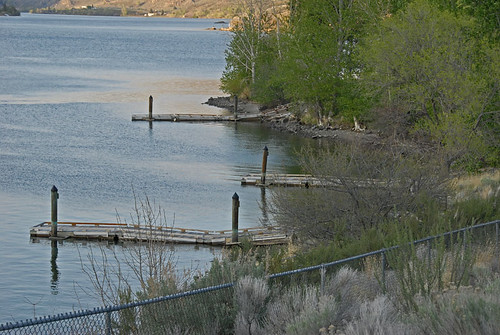
This is the waterfront area of the park with the boating docks that are beside the tenting area, to the right in this photo. Swimming is permitted here but the water is pretty cold. I am not a fisherman but understand that it is quite good. You can see some of the sage brush in the lower part of this view although it really shows up better in the earlier photo. As it gets hotter the rattle snakes come out so those wild places are not all that great to walk through.
We enjoyed our stay here although we didn't really spend a lot of time in the park. There is no cable TV although you can connect easily to all of the network channels from Spokane via your RV antennae. Of course next year we will have to get one of those boxes to convert over the air signals to analog when all broadcast TV goes to digital. Or buy a new TV and antennae for the rig.
Re: the TV and converter box, etc - I think I'd just invest in a DVD player and take some DVD's along with me, or find alternate entertainment. Then again, I'm not much on TV to begin with.
Looking forward to the next set of pics.
Love and hugs,
Diane
<< Home


