Sunday, May 25, 2008
Two campgrounds
I decided to fit a few photos from two campgrounds on our trip into one post. These are both on the Cascade Loop trip that is pretty popular here as it gives quite a variety of climates and landscapes to see. This part of the state is hotter in the summer than what we like and colder in the winter but it is great in the spring and fall and we were in both of these places in early May.

This first campground is a large city park on the shore of Lake Chelan and in the city of Chelan, WA. Lake Chelan is many miles long and I think the third deepest lake in the country. If you look at the mountains surrounding the lake you can visualize how far down it would be to the bottom. We stayed fairly close to the entrance as I wanted to be able to connect to the free WiFi the campground offers but there are some sites that are much closer to the lake. The only negative is that the place is already full with reservations for every weekend until September!
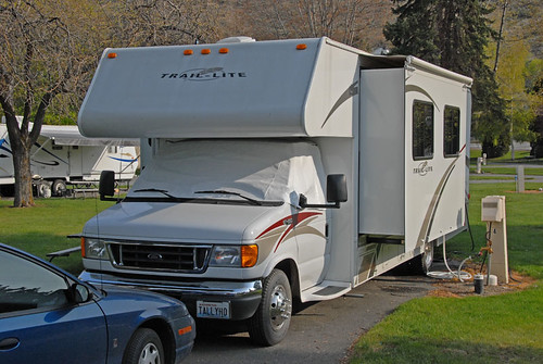
Our RV hooked up in our site. There are 165 sites and all but two are full hookup sites. I didn't hook us up to the sewer until we started to pull out when we left. The connection was farther forward than what I wanted to run our drain hose. We only spent two nights in the park and our holding tanks will easily cover that long even with two daily showers.
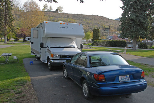
The other side of the RV. I have raised the front with the jacks to level the rig so we added our little step stool below the steps coming out. Notice the hill in the background and the house up there on top. The Chelan area has really been gaining popularity as a place to get away to from Pugetopolis since it is only about a two hour drive from Seattle. That of course has pushed prices up. A lot. I understand that waterfront land along the lake is now sold by the inch of frontage on the lake. I don't like the idea of paying half a million dollars for a two bedroom cabin, even if it is on the lake!
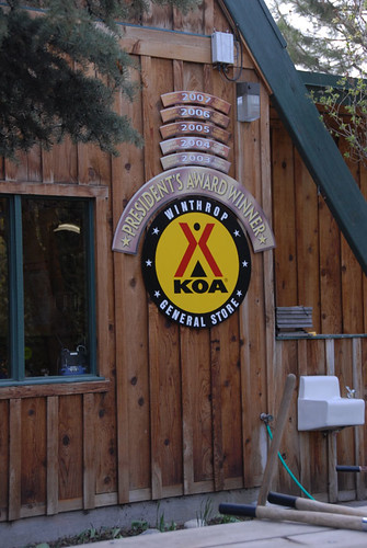
Our last campground stop on the Loop was in the town of Winthrop. It is on the east side of the North Cascades Highway that crosses two high mountain passes on State Route 20. The road closes in the winter as they don't even try to clear it of it's 60+ feet of snow until spring arrives. Winthrop has adopted or stayed with a Western theme, with board sidewalks, etc. The photos I posted earlier of the deer crossing the highway were taken right out in front of this KOA campground. This sign is on the front of the store/office as you enter. I have stayed here over the years and always enjoy it. The place is owned by a brother and sister and their families. I don't normally stay in KOA's (too expensive) but make an exception for this one.
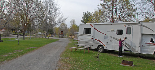
Pat is entering the RV and you can see the front is up pretty high. I don't know why we always seem to park in sites where the front is low. The jacks took care of leveling the rig but I did add two wood blocks under each jack in order to get the height we needed. The sites here are all on grass which is really more comfortable in the heat of the summer, and it does get hot here. The day we arrived, May 4th, it was about 80 degrees. Add another 20 to that for July & August.
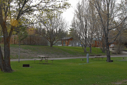
The North Cascades Hwy had just reopened on May 1st and the town is just waking up from it's winter nap. Many of the residents here close things up for the winter and go south, including the owners of this campground. The swimming pool is in the background of this photo, up on that little hill, and they are just getting it ready to open. You can see the store/office building at the right side of the photo. The Methow River runs alongside the campground, in front of our rig. This is one of the best fishing places in the state.
I'll have a post on our wine tasting in Wenatchee and Chelan to post soon, as well as some photos from in the town of Winthrop and the pass going back home to our wet but cooler side of the mountains. Hwy 20 drops us right into our back yard on the west side of the mountains. There was a lot of snow up there and just a couple of weeks later the pass was closed again for nearly a week due to avalanches dumping lots of snow, rocks and tree parts on the roadway.
This first campground is a large city park on the shore of Lake Chelan and in the city of Chelan, WA. Lake Chelan is many miles long and I think the third deepest lake in the country. If you look at the mountains surrounding the lake you can visualize how far down it would be to the bottom. We stayed fairly close to the entrance as I wanted to be able to connect to the free WiFi the campground offers but there are some sites that are much closer to the lake. The only negative is that the place is already full with reservations for every weekend until September!
Our RV hooked up in our site. There are 165 sites and all but two are full hookup sites. I didn't hook us up to the sewer until we started to pull out when we left. The connection was farther forward than what I wanted to run our drain hose. We only spent two nights in the park and our holding tanks will easily cover that long even with two daily showers.
The other side of the RV. I have raised the front with the jacks to level the rig so we added our little step stool below the steps coming out. Notice the hill in the background and the house up there on top. The Chelan area has really been gaining popularity as a place to get away to from Pugetopolis since it is only about a two hour drive from Seattle. That of course has pushed prices up. A lot. I understand that waterfront land along the lake is now sold by the inch of frontage on the lake. I don't like the idea of paying half a million dollars for a two bedroom cabin, even if it is on the lake!
Our last campground stop on the Loop was in the town of Winthrop. It is on the east side of the North Cascades Highway that crosses two high mountain passes on State Route 20. The road closes in the winter as they don't even try to clear it of it's 60+ feet of snow until spring arrives. Winthrop has adopted or stayed with a Western theme, with board sidewalks, etc. The photos I posted earlier of the deer crossing the highway were taken right out in front of this KOA campground. This sign is on the front of the store/office as you enter. I have stayed here over the years and always enjoy it. The place is owned by a brother and sister and their families. I don't normally stay in KOA's (too expensive) but make an exception for this one.
Pat is entering the RV and you can see the front is up pretty high. I don't know why we always seem to park in sites where the front is low. The jacks took care of leveling the rig but I did add two wood blocks under each jack in order to get the height we needed. The sites here are all on grass which is really more comfortable in the heat of the summer, and it does get hot here. The day we arrived, May 4th, it was about 80 degrees. Add another 20 to that for July & August.
The North Cascades Hwy had just reopened on May 1st and the town is just waking up from it's winter nap. Many of the residents here close things up for the winter and go south, including the owners of this campground. The swimming pool is in the background of this photo, up on that little hill, and they are just getting it ready to open. You can see the store/office building at the right side of the photo. The Methow River runs alongside the campground, in front of our rig. This is one of the best fishing places in the state.
I'll have a post on our wine tasting in Wenatchee and Chelan to post soon, as well as some photos from in the town of Winthrop and the pass going back home to our wet but cooler side of the mountains. Hwy 20 drops us right into our back yard on the west side of the mountains. There was a lot of snow up there and just a couple of weeks later the pass was closed again for nearly a week due to avalanches dumping lots of snow, rocks and tree parts on the roadway.
Labels: Pat and I, Photos, RVing, Small towns, Trips to see things
Monday, May 19, 2008
Rocky Reach Dam, Wenatchee WA
One of the places we visited while in the town of Wenatchee, WA on our recent RV trip was the Rocky Reach Dam. It is about 5 miles upriver from Wenatchee on the Columbia River and is owned by the Chelan County Public Utility District, one of three dams they own and operate. Washington State University was heavily involved in the design and development of the dam. It was built in the 1950s & 60s but is continuously being updated. Fairly recently they expanded from 7 to 11 generators and just a couple of years ago a special project was completed to assist fingerling salmon on their downriver trip to the Pacific Ocean. There are probably others that are not obvious and I am not aware of.

This first photo shows the dam on the downriver side. The fish ladder that was built with the original construction to assist fish returning to spawn is shown at the lower part of the photo and the large pipe that has recently been finished to help the fingerlings on their journey downstream is in the upper part of the photo at the left side. The area around the dam is desert but it has been made agriculturally very productive with the addition of irrigation. Wenatchee, along with the nearby town of Chelan, has long been known for their fruit production, especially apples, although grapes have become a major competitor for that honor in recent years.
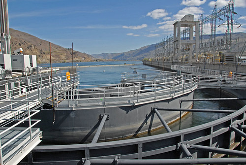
We are looking at the upriver side of the dam. This part of the Columbia River is known as Lake Entiat. The town of Entiat is about 12 -15 miles farther upriver and part of it had to be relocated before the area was flooded by the new dam. Fishing, water skiing and other water sports are very popular in this area where they experience over 300 days of sunshine per year. It is quite hot in the summer and pretty cold in the winter. This view shows the large power lines that are on top of the dam above where the generators are located. In the near foreground is what I think is the top part of the fish ladder.
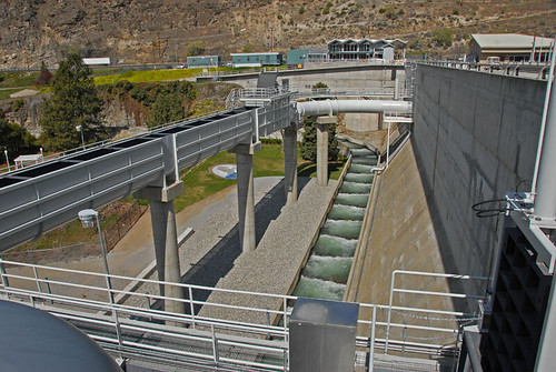
This view shows both the fish ladder and the pipe that is part of the new fingerling way of getting downriver past the dam. It also shows a small part of the beautifully landscaped 16 acre park that is open to the public for picnics, weddings, etc.
This is more of the fingerling pathway. This pipe, sometimes open on top, sometimes enclosed as it is here, carries water and the small fingerlings past the dam, safe from having to go through the generator turbines. You can see the outlet of this pipe in the background, where it dumps the fish into the water. There was a lot of planning that went into designing this. The outlet has been proven to not damage the small fish by dumping them into the water and the location was selected because it is a deep part of the river and also one with a fairly strong current. The current helps to keep them safer from predators, mainly pike fish and birds.
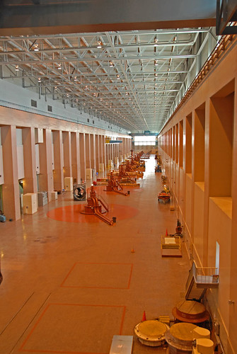
The 11 generators are below in this very large room. You used to be able to go on a tour below but that has been canceled due to terrorism concerns. I can't remember the size of these generators, but they are pretty large. The dam was originally built with 7 generators and the 4 that were added later are each more than half again the size of each of the first 7. All together they output a lot of pollution free electrical power.
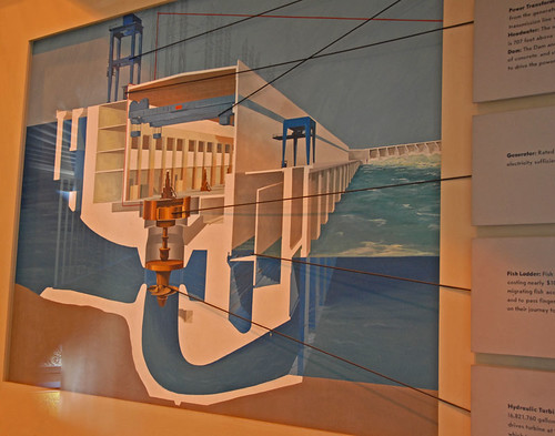
This chart graphically shows how the dam is laid out. The generator section kind of runs in a upstream/downstream direction while the spill ways for excess water is in the background and runs across the river. You can see the fish ladder section in this view but it does not have the newer fingerling tube section.
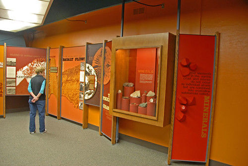
There is a great museum that is inside the dam itself. There are three main things covered in the museum- the native people from the area, the story of the area settlers & building the dam, and a lot of info about the geology of the area, including what it was like millions of years ago and the upheavals of various types that occurred to make it what it looks like now.
Here Pat is looking at some of the geological info displayed.
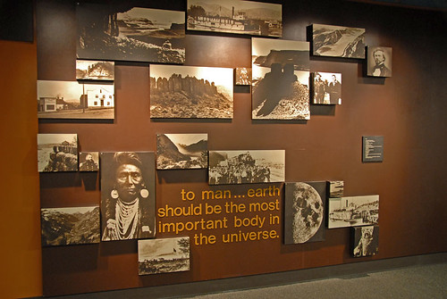
This is a small part of the info on the native peoples of the area.
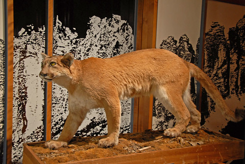
There are a great many natives of the area and this is just another of them. Cougars are not a major part of the area but they are around. During part of the year you are a lot more likely to see a rattle snake than a cougar in this area.
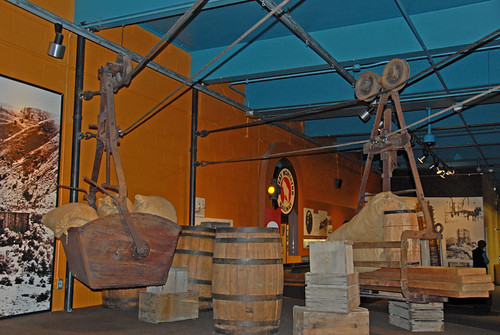
Tramway's were the first way of getting goods across the Columbia River, other than boats & barges. The first bridge build was the railroad bridge but when the RR first came to the area, it's cars were transported across on barges. The first auto bridge is still there but it is used only as a way to moving fresh water from the Wenatchee side to the dryer East Wenatchee side, and as a pedestrian & bicycle route across the river. There are at least two good auto bridges within the Wenatchee town boundaries. This photo shows an example of one of those early tramway's.
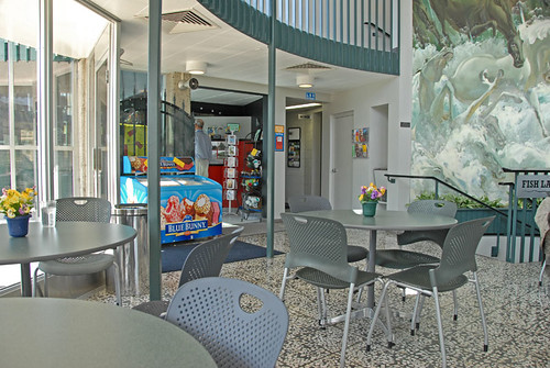
Rocky Reach Dam has become a very popular tourist spot so of course it has to have a gift shop & cafe. This pleasant lobby is just inside the entrance way and offers a nice mural as well as a glass wall to look out at the dam while you are enjoying food. And, they do make a pretty good mocha!
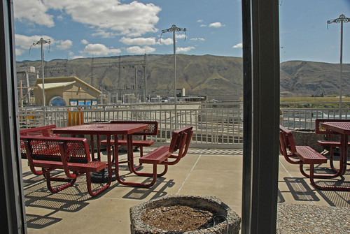
Here is a part of the view outside the dining lobby. Those outside tables are a good place to eat when it isn't either too cold or too hot ourdoors.
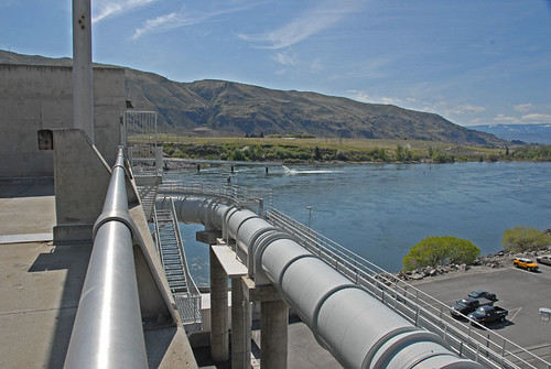
If you visit this area, I strongly recommend this as a tour that is well worth your time. And it is free, unless you buy something in the gift shop or cafe. Our mochas were favorably priced. The campground we stayed in, Lincoln Rock State Park, is located just upriver from the dam on the east side of the river. It is necessary to drive about 5 miles to the freeway bridge across the river, then back upriver to the dam entrance, as there is no vehicle traffic across it.
This first photo shows the dam on the downriver side. The fish ladder that was built with the original construction to assist fish returning to spawn is shown at the lower part of the photo and the large pipe that has recently been finished to help the fingerlings on their journey downstream is in the upper part of the photo at the left side. The area around the dam is desert but it has been made agriculturally very productive with the addition of irrigation. Wenatchee, along with the nearby town of Chelan, has long been known for their fruit production, especially apples, although grapes have become a major competitor for that honor in recent years.
We are looking at the upriver side of the dam. This part of the Columbia River is known as Lake Entiat. The town of Entiat is about 12 -15 miles farther upriver and part of it had to be relocated before the area was flooded by the new dam. Fishing, water skiing and other water sports are very popular in this area where they experience over 300 days of sunshine per year. It is quite hot in the summer and pretty cold in the winter. This view shows the large power lines that are on top of the dam above where the generators are located. In the near foreground is what I think is the top part of the fish ladder.
This view shows both the fish ladder and the pipe that is part of the new fingerling way of getting downriver past the dam. It also shows a small part of the beautifully landscaped 16 acre park that is open to the public for picnics, weddings, etc.
This is more of the fingerling pathway. This pipe, sometimes open on top, sometimes enclosed as it is here, carries water and the small fingerlings past the dam, safe from having to go through the generator turbines. You can see the outlet of this pipe in the background, where it dumps the fish into the water. There was a lot of planning that went into designing this. The outlet has been proven to not damage the small fish by dumping them into the water and the location was selected because it is a deep part of the river and also one with a fairly strong current. The current helps to keep them safer from predators, mainly pike fish and birds.
The 11 generators are below in this very large room. You used to be able to go on a tour below but that has been canceled due to terrorism concerns. I can't remember the size of these generators, but they are pretty large. The dam was originally built with 7 generators and the 4 that were added later are each more than half again the size of each of the first 7. All together they output a lot of pollution free electrical power.
This chart graphically shows how the dam is laid out. The generator section kind of runs in a upstream/downstream direction while the spill ways for excess water is in the background and runs across the river. You can see the fish ladder section in this view but it does not have the newer fingerling tube section.
There is a great museum that is inside the dam itself. There are three main things covered in the museum- the native people from the area, the story of the area settlers & building the dam, and a lot of info about the geology of the area, including what it was like millions of years ago and the upheavals of various types that occurred to make it what it looks like now.
Here Pat is looking at some of the geological info displayed.
This is a small part of the info on the native peoples of the area.
There are a great many natives of the area and this is just another of them. Cougars are not a major part of the area but they are around. During part of the year you are a lot more likely to see a rattle snake than a cougar in this area.
Tramway's were the first way of getting goods across the Columbia River, other than boats & barges. The first bridge build was the railroad bridge but when the RR first came to the area, it's cars were transported across on barges. The first auto bridge is still there but it is used only as a way to moving fresh water from the Wenatchee side to the dryer East Wenatchee side, and as a pedestrian & bicycle route across the river. There are at least two good auto bridges within the Wenatchee town boundaries. This photo shows an example of one of those early tramway's.
Rocky Reach Dam has become a very popular tourist spot so of course it has to have a gift shop & cafe. This pleasant lobby is just inside the entrance way and offers a nice mural as well as a glass wall to look out at the dam while you are enjoying food. And, they do make a pretty good mocha!
Here is a part of the view outside the dining lobby. Those outside tables are a good place to eat when it isn't either too cold or too hot ourdoors.
If you visit this area, I strongly recommend this as a tour that is well worth your time. And it is free, unless you buy something in the gift shop or cafe. Our mochas were favorably priced. The campground we stayed in, Lincoln Rock State Park, is located just upriver from the dam on the east side of the river. It is necessary to drive about 5 miles to the freeway bridge across the river, then back upriver to the dam entrance, as there is no vehicle traffic across it.
Labels: Desert, Photos, Small towns, Trips to see things
Sunday, May 11, 2008
Lincoln Rock State Park, Wenatchee WA
The second campground we stayed in while on our recent RV trip around the North Cascades Loop was Lincoln Rock State Park. It is on the east side of the Columbia River about five miles upriver from the town of East Wenatchee, which is just across the river from the town of Wenatchee. I guess they were having a hard time trying to come up with a name for the place, so took the easy way. The town, not the park.
The park is located just above Rocky Reach Dam which is one of three on the Columbia that are owned by Chelan County Public Utility District. Well, one of them is at the outlet of Lake Chelan so technically it isn't on the Columbia, but it is pretty close. We toured the dam and will have some interesting photos from there that I'll get to in another post.

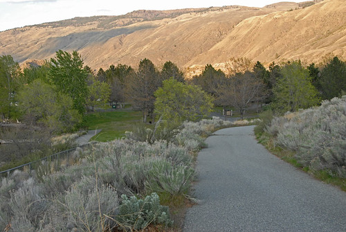
This first photo will show you a bit about how the terrain looks over there in this part of Eastern Washington. It was truly desert before irrigation water was added. I think the only trees were planted although some along the river shores have probably developed on their own. One really neat thing about most of the State Park campgrounds is that they have lots of space, so the sites are not squeezed in real close together like most in commercial campgrounds seem to be.

That first photo was taken in front of our campsite and this one is from the same place but looking in the opposite direction. This is in the full hookup area of the park so it mostly RVs as tenters don't need all the hookups and usually go into a lower priced area especially for them.
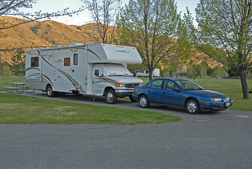
This was our space #48, with our motorhome and Saturn toad (tow car) parked there. You can see how much space there is inside the loop road that goes around the campground by looking behind our rig. That other RV that is behind the tree is quite a ways away.
This pathway goes downhill from the full hookup sites to the tenting area and the improved shoreline. There are docks there to tie your boat up to although there were no boats there when we were there. Wait until summer! There are more trees in the tenting area, probably to provide shade as it regularly gets over 100 degrees in this part of the state in the summer, and most tents do not have air conditioners.
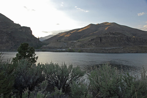
This is a view looking west across the Columbia River. I really like the way the sun is hitting those hills over there, shortly before sunset time. The roadway on the other side is US-97A (alternate) while the regular US-97 is on our side. Later they join farther upriver and it is just US-97 that continues north.
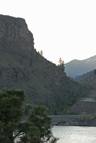
This is looking at the same area but with a longer lens. The rock that this park was named for is in this view and was named back in the 1800s by some of the original settlers who felt that part of the rock over there resembled a profile view of Abraham Lincoln.
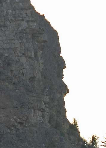
This is an even closer view of the head of Lincoln. It is a bit of a stretch to see it but I am able to visualize the resemblance and think you can, too.
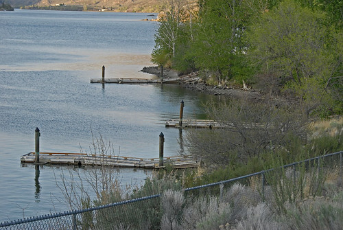
This is the waterfront area of the park with the boating docks that are beside the tenting area, to the right in this photo. Swimming is permitted here but the water is pretty cold. I am not a fisherman but understand that it is quite good. You can see some of the sage brush in the lower part of this view although it really shows up better in the earlier photo. As it gets hotter the rattle snakes come out so those wild places are not all that great to walk through.
We enjoyed our stay here although we didn't really spend a lot of time in the park. There is no cable TV although you can connect easily to all of the network channels from Spokane via your RV antennae. Of course next year we will have to get one of those boxes to convert over the air signals to analog when all broadcast TV goes to digital. Or buy a new TV and antennae for the rig.
The park is located just above Rocky Reach Dam which is one of three on the Columbia that are owned by Chelan County Public Utility District. Well, one of them is at the outlet of Lake Chelan so technically it isn't on the Columbia, but it is pretty close. We toured the dam and will have some interesting photos from there that I'll get to in another post.
This first photo will show you a bit about how the terrain looks over there in this part of Eastern Washington. It was truly desert before irrigation water was added. I think the only trees were planted although some along the river shores have probably developed on their own. One really neat thing about most of the State Park campgrounds is that they have lots of space, so the sites are not squeezed in real close together like most in commercial campgrounds seem to be.
That first photo was taken in front of our campsite and this one is from the same place but looking in the opposite direction. This is in the full hookup area of the park so it mostly RVs as tenters don't need all the hookups and usually go into a lower priced area especially for them.
This was our space #48, with our motorhome and Saturn toad (tow car) parked there. You can see how much space there is inside the loop road that goes around the campground by looking behind our rig. That other RV that is behind the tree is quite a ways away.
This pathway goes downhill from the full hookup sites to the tenting area and the improved shoreline. There are docks there to tie your boat up to although there were no boats there when we were there. Wait until summer! There are more trees in the tenting area, probably to provide shade as it regularly gets over 100 degrees in this part of the state in the summer, and most tents do not have air conditioners.
This is a view looking west across the Columbia River. I really like the way the sun is hitting those hills over there, shortly before sunset time. The roadway on the other side is US-97A (alternate) while the regular US-97 is on our side. Later they join farther upriver and it is just US-97 that continues north.
This is looking at the same area but with a longer lens. The rock that this park was named for is in this view and was named back in the 1800s by some of the original settlers who felt that part of the rock over there resembled a profile view of Abraham Lincoln.
This is an even closer view of the head of Lincoln. It is a bit of a stretch to see it but I am able to visualize the resemblance and think you can, too.
This is the waterfront area of the park with the boating docks that are beside the tenting area, to the right in this photo. Swimming is permitted here but the water is pretty cold. I am not a fisherman but understand that it is quite good. You can see some of the sage brush in the lower part of this view although it really shows up better in the earlier photo. As it gets hotter the rattle snakes come out so those wild places are not all that great to walk through.
We enjoyed our stay here although we didn't really spend a lot of time in the park. There is no cable TV although you can connect easily to all of the network channels from Spokane via your RV antennae. Of course next year we will have to get one of those boxes to convert over the air signals to analog when all broadcast TV goes to digital. Or buy a new TV and antennae for the rig.
Thursday, May 08, 2008
More from Leavenworth, WA
I have a few more photos from Icicle River RV Park and the town of Leavenworth, WA. That was where our trip started so I probably should put these up first. I actually had one I'd worked up today to use in this post when I discovered it is one that I had posted from on the road while we were in Leavenworth! I didn't notice it first as those photos were worked on in Photoshop in my laptop computer and here at home I'm using the desktop machine, so I didn't have it already here. I won't post it again.
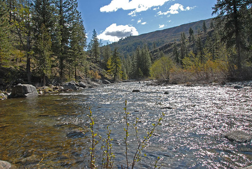
This first photo is a landscape taken from right in front of our RV space in the park and is looking down stream at the river. During the three days we were there we noticed that the river was rising, due to snow melt in the mountains. The water is very cold as it was snow just a short time before it arrives here. See why it is named the Icicle River?
This view is looking up-river from a few spaces away from where we were parked. One of the ways we noticed the water was rising is that the first evening we were in the park I was able to walk out onto one of these large rocks to take photos from right in the river. By the time we left, three days later, that rock was under water.
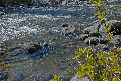
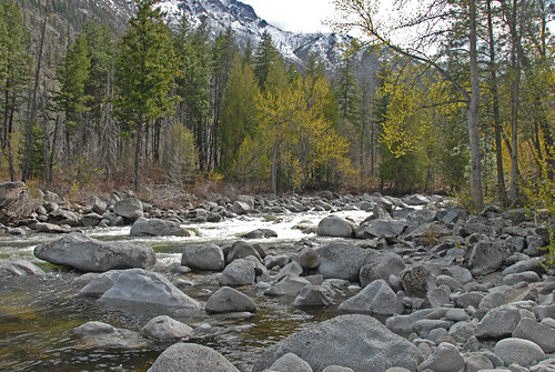
There is a pretty good currant in the river. I didn't see any fish but am sure they are there. The elevation here is only about 1263' so I don't think this river actually freezes over at this point but I've never been here in the winter. I am not fond of snow and they measure it in feet here in the winter.
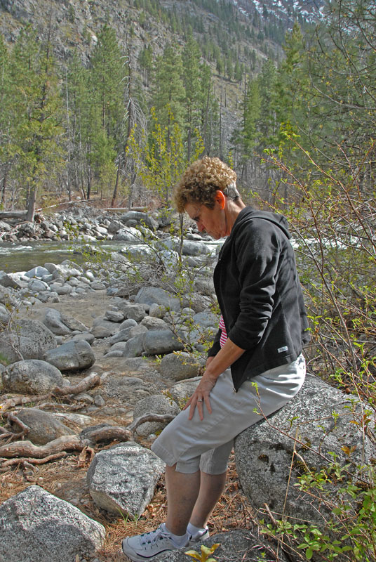
There is a lot of beauty in the outdoors and I think my bride adds to that beauty. Those rocks can be hard to sit on but she did so that I could take some photos. This is probably the best one of her and that still shows quite a bit of the background.
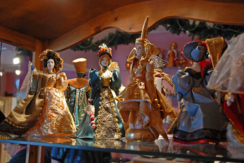
One of the stores in the town of Leavenworth is a Russian store and these dolls are there for sale. The prices are pretty high so we only looked, but the items offered there are beautiful.

Icicle River RV Park now has at least five of these little cabins that can be rented. I do not know what they charge for them. We just looked in the windows and all I saw was bunks to put sleeping bags on. I don't think they have any cooking facilities nor restrooms but there is a nice restroom building near the five cabins. I think these are much like the cabins offered by KOA campgrounds.
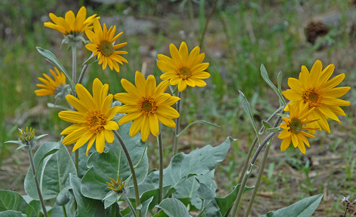
These flowers are all over the place in the Leavenworth area at this time of the year. I was thinking they are skunk weeds but Pat doesn't think so. At any rate, they are bright and cheerful.
Leavenworth is a town that almost died when the railroad left that line in the 1960s. A local resident visited family in the Bavarian area of Germany and when he returned he noticed the similarities of the setting Leavenworth is in compared to Bavaria. He sold the community on building a "Bavarian Village" and they did. It is now one of the favorite tourist places in the state for both locals and out of state visitors. There are festivals going on there on a regular basis and they are now preparing to build a new train passenger station as the railroad has resumed using that cross state line. I think they will run tour trains at least from the Seattle/Everett side of the mountains and maybe will come from Spokane to the east also. Right now there is an occasional train trip available to there in the winter for their "Tree Lighting Ceremony" but when this resumes it is a trip that I want to take. I love trains.
This first photo is a landscape taken from right in front of our RV space in the park and is looking down stream at the river. During the three days we were there we noticed that the river was rising, due to snow melt in the mountains. The water is very cold as it was snow just a short time before it arrives here. See why it is named the Icicle River?
This view is looking up-river from a few spaces away from where we were parked. One of the ways we noticed the water was rising is that the first evening we were in the park I was able to walk out onto one of these large rocks to take photos from right in the river. By the time we left, three days later, that rock was under water.
There is a pretty good currant in the river. I didn't see any fish but am sure they are there. The elevation here is only about 1263' so I don't think this river actually freezes over at this point but I've never been here in the winter. I am not fond of snow and they measure it in feet here in the winter.
There is a lot of beauty in the outdoors and I think my bride adds to that beauty. Those rocks can be hard to sit on but she did so that I could take some photos. This is probably the best one of her and that still shows quite a bit of the background.
One of the stores in the town of Leavenworth is a Russian store and these dolls are there for sale. The prices are pretty high so we only looked, but the items offered there are beautiful.
Icicle River RV Park now has at least five of these little cabins that can be rented. I do not know what they charge for them. We just looked in the windows and all I saw was bunks to put sleeping bags on. I don't think they have any cooking facilities nor restrooms but there is a nice restroom building near the five cabins. I think these are much like the cabins offered by KOA campgrounds.
These flowers are all over the place in the Leavenworth area at this time of the year. I was thinking they are skunk weeds but Pat doesn't think so. At any rate, they are bright and cheerful.
Leavenworth is a town that almost died when the railroad left that line in the 1960s. A local resident visited family in the Bavarian area of Germany and when he returned he noticed the similarities of the setting Leavenworth is in compared to Bavaria. He sold the community on building a "Bavarian Village" and they did. It is now one of the favorite tourist places in the state for both locals and out of state visitors. There are festivals going on there on a regular basis and they are now preparing to build a new train passenger station as the railroad has resumed using that cross state line. I think they will run tour trains at least from the Seattle/Everett side of the mountains and maybe will come from Spokane to the east also. Right now there is an occasional train trip available to there in the winter for their "Tree Lighting Ceremony" but when this resumes it is a trip that I want to take. I love trains.
Labels: Flowers, Pat and I, Photos, RVing, Small towns, Trips to see things
Wednesday, May 07, 2008
Back from our RV trip
I have quite a few photos and things to cover but will break them down into smaller bits and make multiple posts about our 8 day trip. We got home Monday afternoon and I would say it was a wonderful trip. We had sunshine everyday although a couple of them had filtered sunshine at least part of the day. We rarely needed jackets and the last full day in Winthrop was to enjoy what to us is almost summer like weather with a high temperature for the day of about 80 degrees. I have a few photos I've gotten ready to post and they are from our last evening on the road but they did get our interest. We had been warned to watch out for deer while driving up the Methow River toward the town of Winthrop and did in fact see one deer that had been hit alongside the roadway.
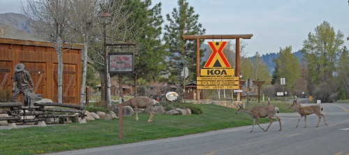
When we were returning to the campground about 18:30 Sunday evening we saw this scene just as we approached the turn off into our campground. These three deer just ambled across the highway in front of us and didn't pause much in their grazing on the lawn while I stopped the car and took photos of them.
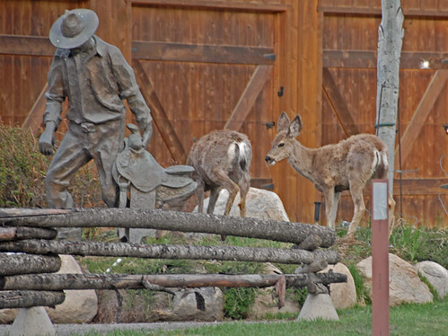
They looked to us like a family. This photo has what we think was the doe and fawn although the fawn appears to be close to full grown.
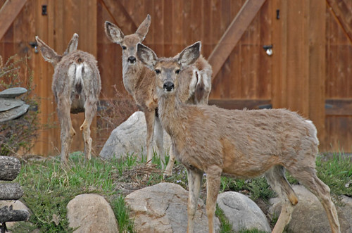
Here are all three of them in a closer view. As you can see they still have their winter coats on so are not as nice and sleek looking as they will be soon, but they do seem to be healthy.
I will get to more of the photos soon and hope to be able to do a post a day for awhile. It was kind of awkward from the road as we didn't have Internet connections in all of the campgrounds and I only had the laptop computer to work on the photos. I have gotten spoiled with the speed of my desktop PC and it's larger monitor to view the photos on as I work with them. I also knew that I'd end up redoing much of what I did on the road when I got home as I have a way I like to store them here and the set has grown so large that I really don't try to work with all of them on the laptop and its smaller hard drives.
When we were returning to the campground about 18:30 Sunday evening we saw this scene just as we approached the turn off into our campground. These three deer just ambled across the highway in front of us and didn't pause much in their grazing on the lawn while I stopped the car and took photos of them.
They looked to us like a family. This photo has what we think was the doe and fawn although the fawn appears to be close to full grown.
Here are all three of them in a closer view. As you can see they still have their winter coats on so are not as nice and sleek looking as they will be soon, but they do seem to be healthy.
I will get to more of the photos soon and hope to be able to do a post a day for awhile. It was kind of awkward from the road as we didn't have Internet connections in all of the campgrounds and I only had the laptop computer to work on the photos. I have gotten spoiled with the speed of my desktop PC and it's larger monitor to view the photos on as I work with them. I also knew that I'd end up redoing much of what I did on the road when I got home as I have a way I like to store them here and the set has grown so large that I really don't try to work with all of them on the laptop and its smaller hard drives.
Labels: Photos, RVing, Small towns
![]()
