Monday, May 19, 2008
Rocky Reach Dam, Wenatchee WA
One of the places we visited while in the town of Wenatchee, WA on our recent RV trip was the Rocky Reach Dam. It is about 5 miles upriver from Wenatchee on the Columbia River and is owned by the Chelan County Public Utility District, one of three dams they own and operate. Washington State University was heavily involved in the design and development of the dam. It was built in the 1950s & 60s but is continuously being updated. Fairly recently they expanded from 7 to 11 generators and just a couple of years ago a special project was completed to assist fingerling salmon on their downriver trip to the Pacific Ocean. There are probably others that are not obvious and I am not aware of.

This first photo shows the dam on the downriver side. The fish ladder that was built with the original construction to assist fish returning to spawn is shown at the lower part of the photo and the large pipe that has recently been finished to help the fingerlings on their journey downstream is in the upper part of the photo at the left side. The area around the dam is desert but it has been made agriculturally very productive with the addition of irrigation. Wenatchee, along with the nearby town of Chelan, has long been known for their fruit production, especially apples, although grapes have become a major competitor for that honor in recent years.
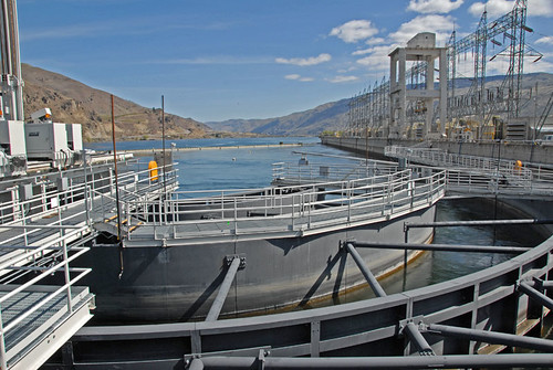
We are looking at the upriver side of the dam. This part of the Columbia River is known as Lake Entiat. The town of Entiat is about 12 -15 miles farther upriver and part of it had to be relocated before the area was flooded by the new dam. Fishing, water skiing and other water sports are very popular in this area where they experience over 300 days of sunshine per year. It is quite hot in the summer and pretty cold in the winter. This view shows the large power lines that are on top of the dam above where the generators are located. In the near foreground is what I think is the top part of the fish ladder.
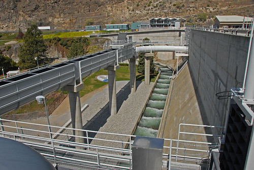
This view shows both the fish ladder and the pipe that is part of the new fingerling way of getting downriver past the dam. It also shows a small part of the beautifully landscaped 16 acre park that is open to the public for picnics, weddings, etc.
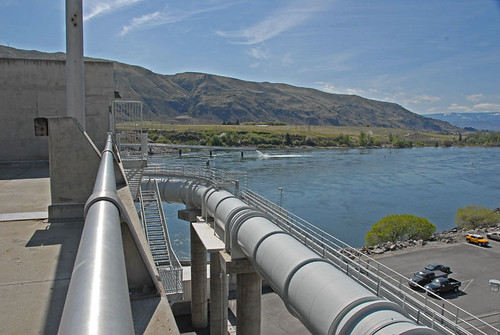
This is more of the fingerling pathway. This pipe, sometimes open on top, sometimes enclosed as it is here, carries water and the small fingerlings past the dam, safe from having to go through the generator turbines. You can see the outlet of this pipe in the background, where it dumps the fish into the water. There was a lot of planning that went into designing this. The outlet has been proven to not damage the small fish by dumping them into the water and the location was selected because it is a deep part of the river and also one with a fairly strong current. The current helps to keep them safer from predators, mainly pike fish and birds.
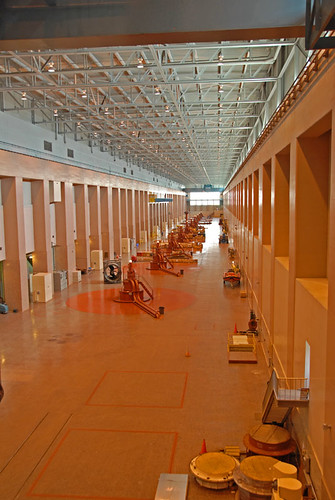
The 11 generators are below in this very large room. You used to be able to go on a tour below but that has been canceled due to terrorism concerns. I can't remember the size of these generators, but they are pretty large. The dam was originally built with 7 generators and the 4 that were added later are each more than half again the size of each of the first 7. All together they output a lot of pollution free electrical power.
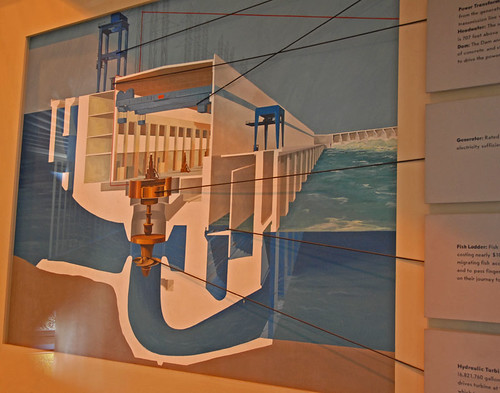
This chart graphically shows how the dam is laid out. The generator section kind of runs in a upstream/downstream direction while the spill ways for excess water is in the background and runs across the river. You can see the fish ladder section in this view but it does not have the newer fingerling tube section.
There is a great museum that is inside the dam itself. There are three main things covered in the museum- the native people from the area, the story of the area settlers & building the dam, and a lot of info about the geology of the area, including what it was like millions of years ago and the upheavals of various types that occurred to make it what it looks like now.
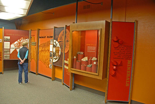
Here Pat is looking at some of the geological info displayed.
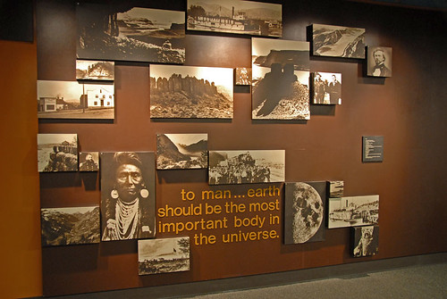
This is a small part of the info on the native peoples of the area.
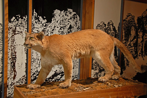
There are a great many natives of the area and this is just another of them. Cougars are not a major part of the area but they are around. During part of the year you are a lot more likely to see a rattle snake than a cougar in this area.
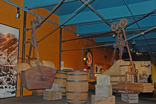
Tramway's were the first way of getting goods across the Columbia River, other than boats & barges. The first bridge build was the railroad bridge but when the RR first came to the area, it's cars were transported across on barges. The first auto bridge is still there but it is used only as a way to moving fresh water from the Wenatchee side to the dryer East Wenatchee side, and as a pedestrian & bicycle route across the river. There are at least two good auto bridges within the Wenatchee town boundaries. This photo shows an example of one of those early tramway's.
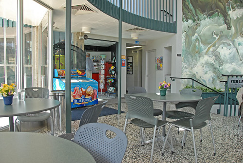
Rocky Reach Dam has become a very popular tourist spot so of course it has to have a gift shop & cafe. This pleasant lobby is just inside the entrance way and offers a nice mural as well as a glass wall to look out at the dam while you are enjoying food. And, they do make a pretty good mocha!
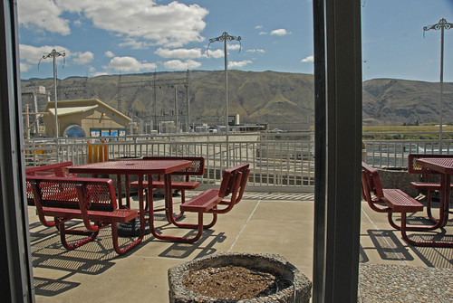
Here is a part of the view outside the dining lobby. Those outside tables are a good place to eat when it isn't either too cold or too hot ourdoors.
If you visit this area, I strongly recommend this as a tour that is well worth your time. And it is free, unless you buy something in the gift shop or cafe. Our mochas were favorably priced. The campground we stayed in, Lincoln Rock State Park, is located just upriver from the dam on the east side of the river. It is necessary to drive about 5 miles to the freeway bridge across the river, then back upriver to the dam entrance, as there is no vehicle traffic across it.
This first photo shows the dam on the downriver side. The fish ladder that was built with the original construction to assist fish returning to spawn is shown at the lower part of the photo and the large pipe that has recently been finished to help the fingerlings on their journey downstream is in the upper part of the photo at the left side. The area around the dam is desert but it has been made agriculturally very productive with the addition of irrigation. Wenatchee, along with the nearby town of Chelan, has long been known for their fruit production, especially apples, although grapes have become a major competitor for that honor in recent years.
We are looking at the upriver side of the dam. This part of the Columbia River is known as Lake Entiat. The town of Entiat is about 12 -15 miles farther upriver and part of it had to be relocated before the area was flooded by the new dam. Fishing, water skiing and other water sports are very popular in this area where they experience over 300 days of sunshine per year. It is quite hot in the summer and pretty cold in the winter. This view shows the large power lines that are on top of the dam above where the generators are located. In the near foreground is what I think is the top part of the fish ladder.
This view shows both the fish ladder and the pipe that is part of the new fingerling way of getting downriver past the dam. It also shows a small part of the beautifully landscaped 16 acre park that is open to the public for picnics, weddings, etc.
This is more of the fingerling pathway. This pipe, sometimes open on top, sometimes enclosed as it is here, carries water and the small fingerlings past the dam, safe from having to go through the generator turbines. You can see the outlet of this pipe in the background, where it dumps the fish into the water. There was a lot of planning that went into designing this. The outlet has been proven to not damage the small fish by dumping them into the water and the location was selected because it is a deep part of the river and also one with a fairly strong current. The current helps to keep them safer from predators, mainly pike fish and birds.
The 11 generators are below in this very large room. You used to be able to go on a tour below but that has been canceled due to terrorism concerns. I can't remember the size of these generators, but they are pretty large. The dam was originally built with 7 generators and the 4 that were added later are each more than half again the size of each of the first 7. All together they output a lot of pollution free electrical power.
This chart graphically shows how the dam is laid out. The generator section kind of runs in a upstream/downstream direction while the spill ways for excess water is in the background and runs across the river. You can see the fish ladder section in this view but it does not have the newer fingerling tube section.
There is a great museum that is inside the dam itself. There are three main things covered in the museum- the native people from the area, the story of the area settlers & building the dam, and a lot of info about the geology of the area, including what it was like millions of years ago and the upheavals of various types that occurred to make it what it looks like now.
Here Pat is looking at some of the geological info displayed.
This is a small part of the info on the native peoples of the area.
There are a great many natives of the area and this is just another of them. Cougars are not a major part of the area but they are around. During part of the year you are a lot more likely to see a rattle snake than a cougar in this area.
Tramway's were the first way of getting goods across the Columbia River, other than boats & barges. The first bridge build was the railroad bridge but when the RR first came to the area, it's cars were transported across on barges. The first auto bridge is still there but it is used only as a way to moving fresh water from the Wenatchee side to the dryer East Wenatchee side, and as a pedestrian & bicycle route across the river. There are at least two good auto bridges within the Wenatchee town boundaries. This photo shows an example of one of those early tramway's.
Rocky Reach Dam has become a very popular tourist spot so of course it has to have a gift shop & cafe. This pleasant lobby is just inside the entrance way and offers a nice mural as well as a glass wall to look out at the dam while you are enjoying food. And, they do make a pretty good mocha!
Here is a part of the view outside the dining lobby. Those outside tables are a good place to eat when it isn't either too cold or too hot ourdoors.
If you visit this area, I strongly recommend this as a tour that is well worth your time. And it is free, unless you buy something in the gift shop or cafe. Our mochas were favorably priced. The campground we stayed in, Lincoln Rock State Park, is located just upriver from the dam on the east side of the river. It is necessary to drive about 5 miles to the freeway bridge across the river, then back upriver to the dam entrance, as there is no vehicle traffic across it.
Labels: Desert, Photos, Small towns, Trips to see things


Saturday, February 11, 2006
Some views of my digs here in Yuma
Yesterday was a quiet day that I spent around the RV, reading & relaxing. I did get in a bike ride & went to dinner at Dairy Queen where I learned we seniors get a 10% discount and Blizzards are their special desert for Mondays. I will need to check that out on Monday. Last night I watched the opening ceremonies of the Winter Olympics on TV.
Today my cousin, J, & I went to The Grocery Store internet cafe for a mocha. But I took some of these photos first as I wanted to get them while the sun was low and from that side of the rig. After our mochas I took Huggy outside and talked with my neighbors for awhile, then took a few more photos & read while soaking up some sun (Cheryl Crowe is singing about soaking up the sun right now on the radio, too!) After that it was time to spend on the desktop PC with Photoshop to get the new pics in the album, decide which ones I wanted on the blog, then reduce their size & move those files to a thumb drive to take to the laptop, upload to Flickr & write this blog post with them included.
The first photo shows my half of the lot with my RV, the Saturn toad (towed car, get it?), bike, etc. The brick walls are built of Mexican brick, which can not be used in my home area of the northwest because it has too much rain. These bricks would just sort of melt up there but work well here and are fairly cheap as well as being colorful.
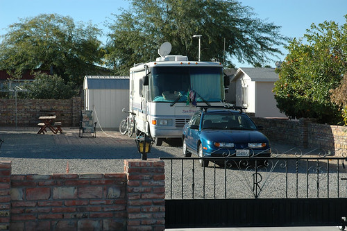
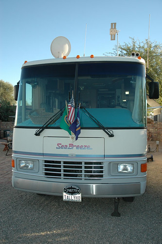
This second photo shows the front of the RV. Notice Huggy's basket on the passenger side of the dashboard. The round antennae is the satellite TV one, the funny looking one on the driver side is for broadcast TV. The new Wilson Trucker antennae is not visible in this view. It is just above and behind the entry door, near the side of the coach.
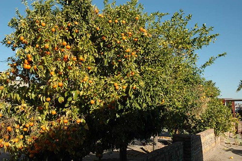
The lot next door on the west side has a mobile home but due to the death of the owner, it is vacant. It has three citrus trees with ripe fruit that is starting to fall off the trees. This first one is something like a satsuma, a kind of small orange that is very good. The next one is a grapefruit tree and the third one is more of a standard orange tree. If you look carefully you will see a grapefruit on the ground on my side of the brick wall.
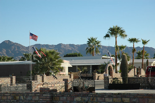
I took a photo looking east across my lot & the one next door and kind of down the street. The lens used was a mild telephoto (like a 105mm on a 35mm film camera) so distances are compressed a bit as a telephoto lens does optically. Everything looks a little closer than it really is. Notice all the antennaes on the mountain tops in the background. I think that is why I get good cell phone & TV reception here.
This is a fun photo. No, it isn't the sun, but that grapefruit that was on the ground in the citrus tree photo, set on the trunk of my blue toad.

I took a break between the Photoshop work and uploading to Flickr to go to Da Boyz restaurant for a pizza for dinner. I got a large one so have half of it left for lunch tomorrow. The full moon is sure beautiful tonight. I used my new binoculars to look at it and they do bring out quite a lot more detail. Tomorrow is Sunday and I think I will go to church.
Today my cousin, J, & I went to The Grocery Store internet cafe for a mocha. But I took some of these photos first as I wanted to get them while the sun was low and from that side of the rig. After our mochas I took Huggy outside and talked with my neighbors for awhile, then took a few more photos & read while soaking up some sun (Cheryl Crowe is singing about soaking up the sun right now on the radio, too!) After that it was time to spend on the desktop PC with Photoshop to get the new pics in the album, decide which ones I wanted on the blog, then reduce their size & move those files to a thumb drive to take to the laptop, upload to Flickr & write this blog post with them included.
The first photo shows my half of the lot with my RV, the Saturn toad (towed car, get it?), bike, etc. The brick walls are built of Mexican brick, which can not be used in my home area of the northwest because it has too much rain. These bricks would just sort of melt up there but work well here and are fairly cheap as well as being colorful.
This second photo shows the front of the RV. Notice Huggy's basket on the passenger side of the dashboard. The round antennae is the satellite TV one, the funny looking one on the driver side is for broadcast TV. The new Wilson Trucker antennae is not visible in this view. It is just above and behind the entry door, near the side of the coach.
The lot next door on the west side has a mobile home but due to the death of the owner, it is vacant. It has three citrus trees with ripe fruit that is starting to fall off the trees. This first one is something like a satsuma, a kind of small orange that is very good. The next one is a grapefruit tree and the third one is more of a standard orange tree. If you look carefully you will see a grapefruit on the ground on my side of the brick wall.
I took a photo looking east across my lot & the one next door and kind of down the street. The lens used was a mild telephoto (like a 105mm on a 35mm film camera) so distances are compressed a bit as a telephoto lens does optically. Everything looks a little closer than it really is. Notice all the antennaes on the mountain tops in the background. I think that is why I get good cell phone & TV reception here.
This is a fun photo. No, it isn't the sun, but that grapefruit that was on the ground in the citrus tree photo, set on the trunk of my blue toad.
I took a break between the Photoshop work and uploading to Flickr to go to Da Boyz restaurant for a pizza for dinner. I got a large one so have half of it left for lunch tomorrow. The full moon is sure beautiful tonight. I used my new binoculars to look at it and they do bring out quite a lot more detail. Tomorrow is Sunday and I think I will go to church.
Sunday, February 05, 2006
Boomerville 2005 from the air
Friday while I was shopping at Rice Ranch in Quartzsite I purchased a DVD with images of the Quartzsite area taken last year, when there had been rain here and the desert was green. It is titled, "Quartzsite 2005 - The year of the green desert." There are about 160 images on the disk and I am posting one here of the Boomer area we call Boomerville. The photos were taken by Bob Lankford of DL Digital Photography, Quartzsite, AZ. If you wish to purchase copies, call Bob at 208-484-7960 or via email at blphoto2002@yahoo.com.
This view is looking east and shows the campfire circle, with people, and the layout of how the RVs are parked. Annie & I were just above the campfire area on the left side, but this photo was taken Jan 17th and we didn't arrive until the 22nd. The entrance is in the upper part of the photo, after a 2 mile drive from the blacktopped frontage road that runs along I-10 east of Q. The difference this year because of the lack of rain is striking - everything is brown with very little green. The creosote bushes have green but that is about all.
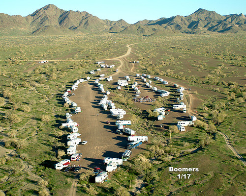
Photo by: Bob Lankford; BL Digital Photography, Quartzsite AZ copyrite 2005 Used with permission.
This view is looking east and shows the campfire circle, with people, and the layout of how the RVs are parked. Annie & I were just above the campfire area on the left side, but this photo was taken Jan 17th and we didn't arrive until the 22nd. The entrance is in the upper part of the photo, after a 2 mile drive from the blacktopped frontage road that runs along I-10 east of Q. The difference this year because of the lack of rain is striking - everything is brown with very little green. The creosote bushes have green but that is about all.
Photo by: Bob Lankford; BL Digital Photography, Quartzsite AZ copyrite 2005 Used with permission.
Friday, February 03, 2006
Boomers, pizza, bonfires, good friends....
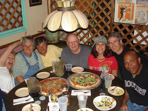
Wednesday night a small group of seven of us went to Silly Al's Pizza for dinner. We found at least three times as many other Boomers had done the same so there were many of us there. Here is a photo of our group of seven:
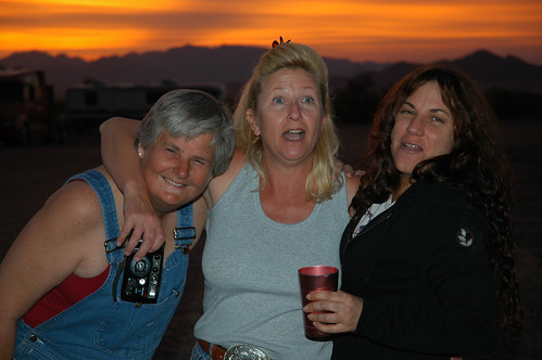
Yesterday I have already covered the morning propane run Huggy & I made, so we were warm last night. Our little group has gathered together in a part of Boomerville and last night we had a barbeque of steaks, salad, wine, bonfire, etc. Here is a photo of the three ladies in the group, with another beautiful desert sunset over the mountains to the west behind them:
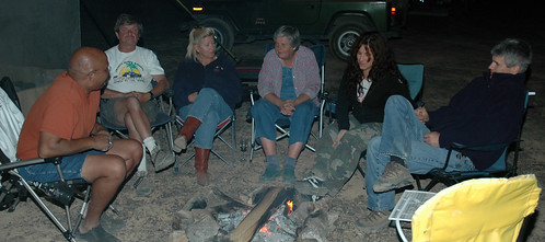
We sat around the fire talking until about 21:00 and here is a photo of that:
Today we hope to find out what is the problem with Jerry & Erica's batteries. There was talk about a run to Dairy Queen for lunch and perhaps fish & chips for dinner. I will see what develops but for now I want to get this posted and go join the others.
Yesterday I have already covered the morning propane run Huggy & I made, so we were warm last night. Our little group has gathered together in a part of Boomerville and last night we had a barbeque of steaks, salad, wine, bonfire, etc. Here is a photo of the three ladies in the group, with another beautiful desert sunset over the mountains to the west behind them:
We sat around the fire talking until about 21:00 and here is a photo of that:
Today we hope to find out what is the problem with Jerry & Erica's batteries. There was talk about a run to Dairy Queen for lunch and perhaps fish & chips for dinner. I will see what develops but for now I want to get this posted and go join the others.
Labels: Desert, Friends, Photos, RVing, SKPs, Sunrises and Sunsets
Friday, January 27, 2006
Two days worth of activities
Yesterday a few of us went into town for lunch at Mark's Family Restaurant, a place we enjoyed last year where they have good food, nice size portions and all at a fair price. After lunch, J & I went to The Big Tent to see the displays & booths there. I didn't buy anything but J bought a few things he needed. We were surprised to discover that time had gotten to 17:00 and the place was closing.
The traffic around there is bad when everyone leaves at once, so I went the oposite direction from where we wanted to go as most traffic wanted to go where we also did. We decided to stop for dinner & let traffic settle down, so we found the Texas Barbeque which turned out to be a good choice. Then back to our RVs for the rest of the evening.
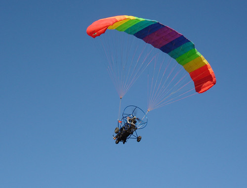
This morning the men in Boomerville went to The Bakery for breakfast. I had a Texas cinnemon roll to go with my cup of coffee. This bakery is small but makes a good variety of excellent baked goods. Here is a photo of the ultralite aircraft that flew over us as we started out for The Bakery.
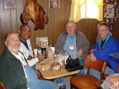
Here is a photo of four of us eating. The fifth one at our table was taking the photo with my small camera while his Nikon D50 rested on the table. (Edit: Names, left to right, are Barry, John, me & Brooks with Padraic taking the photo.)
After breakfast we returned to Boomerville for the rest of the day. I puttered around with the computers & talked with people until time for Happy Hour. I took some photos there and afterwards, including this one which is similar to one taken last year in about the same location. The difference between the one this year
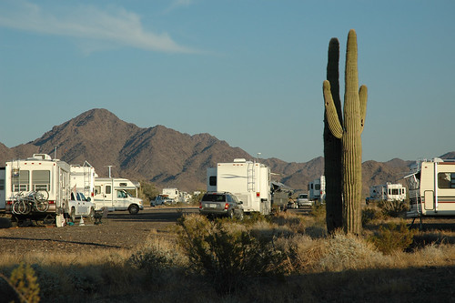
and the one taken last year (same cactus)
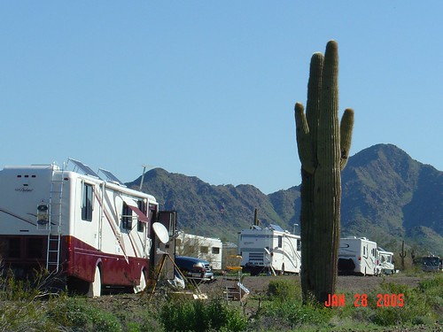
You can see how much greener the desert was last year when there was quite a bit of rain down here.
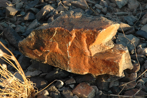
The Quartzsite area is well known for it's rocks & gems. I found this one on the ground as I walked back to my RV after Happy Hour. I don't know what it is - perhaps some of you may know and can let the rest of us know by entering a comment.
I don't know what I will do tomorrow. It is a Saturday & I will have free phone calls all weekend so I will probably take advantage of the strong phone signal here & use it.
The traffic around there is bad when everyone leaves at once, so I went the oposite direction from where we wanted to go as most traffic wanted to go where we also did. We decided to stop for dinner & let traffic settle down, so we found the Texas Barbeque which turned out to be a good choice. Then back to our RVs for the rest of the evening.
This morning the men in Boomerville went to The Bakery for breakfast. I had a Texas cinnemon roll to go with my cup of coffee. This bakery is small but makes a good variety of excellent baked goods. Here is a photo of the ultralite aircraft that flew over us as we started out for The Bakery.
Here is a photo of four of us eating. The fifth one at our table was taking the photo with my small camera while his Nikon D50 rested on the table. (Edit: Names, left to right, are Barry, John, me & Brooks with Padraic taking the photo.)
After breakfast we returned to Boomerville for the rest of the day. I puttered around with the computers & talked with people until time for Happy Hour. I took some photos there and afterwards, including this one which is similar to one taken last year in about the same location. The difference between the one this year
and the one taken last year (same cactus)
You can see how much greener the desert was last year when there was quite a bit of rain down here.
The Quartzsite area is well known for it's rocks & gems. I found this one on the ground as I walked back to my RV after Happy Hour. I don't know what it is - perhaps some of you may know and can let the rest of us know by entering a comment.
I don't know what I will do tomorrow. It is a Saturday & I will have free phone calls all weekend so I will probably take advantage of the strong phone signal here & use it.
Labels: Desert, Friends, Photos, RVing, SKPs
Wednesday, January 25, 2006
Boomerville & some photos
After my first full day in Boomerville I am finally getting a chance to upload some photos. Tomorrow I plan to go into town & visit some of the booths. Quartzsite, Arizona is an unusual town. This link will take you to a National Geographic site about Q and some of the things that go on here during the year. Check it out for more info about this place.
This morning I went on a walk with three others. It was good as I really need to get more exercise. I spotted some places in the desert where I'd like to go to take photos. When back home I got up on the roof to clean & tilt the solar panels. I couldn't believe how dirty they were! Between cleaning & tilting my amperage from them went from below five to about fifteen. I got the desktop PC setup on the table & moved some photos into Photoshop's album, then reduced five of them & moved them to Flickr. I do not have the broadband connection, only the NationalAccess connection that is a little faster than dialup but no comparison to broadband speeds. So, it took a loooong time to transfer them but the system didn't time out on me.
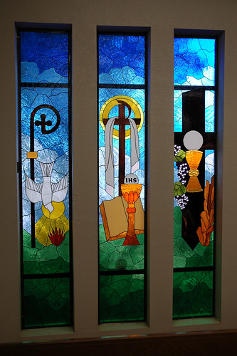
Here is the first one. There are two nice stained glass windows at the Church of the Holy Spirit in Bullhead City and this is one of them:
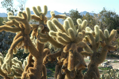
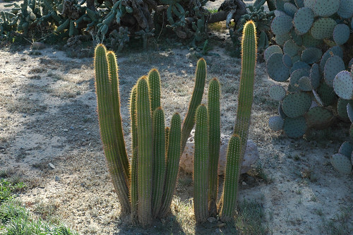
These are two of the photos of cactus' in the cactus garden at Riverside Adventure Trails RV Park in Ft. Mohave, AZ. I do not know the name of either of these:
Here are a couple of photos taken here in Quartzsite at Boomerville. The first one shows some of the rigs here at Boomerville, with the group gathering area & fire ring in the background. You can also see the town of Q in the background, three miles away over the top of the foliage behind the fire ring.
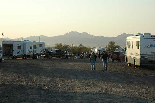
The second photo was taken from the fire ring area looking the opposite direction from the first one. When Annie & I were here last year we parked near the fire ring, about where the yellow truck is parked in this photo. This year I am further up in about the center of the photo. Here is that second photo:
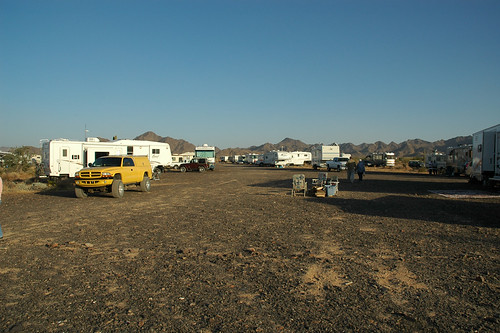
The desert last year was green, with flowers all over the place. This year it has been dry for nearly 100 days and all is brown and dry. Some of my other pictures will show this.
This morning I went on a walk with three others. It was good as I really need to get more exercise. I spotted some places in the desert where I'd like to go to take photos. When back home I got up on the roof to clean & tilt the solar panels. I couldn't believe how dirty they were! Between cleaning & tilting my amperage from them went from below five to about fifteen. I got the desktop PC setup on the table & moved some photos into Photoshop's album, then reduced five of them & moved them to Flickr. I do not have the broadband connection, only the NationalAccess connection that is a little faster than dialup but no comparison to broadband speeds. So, it took a loooong time to transfer them but the system didn't time out on me.
Here is the first one. There are two nice stained glass windows at the Church of the Holy Spirit in Bullhead City and this is one of them:
These are two of the photos of cactus' in the cactus garden at Riverside Adventure Trails RV Park in Ft. Mohave, AZ. I do not know the name of either of these:
Here are a couple of photos taken here in Quartzsite at Boomerville. The first one shows some of the rigs here at Boomerville, with the group gathering area & fire ring in the background. You can also see the town of Q in the background, three miles away over the top of the foliage behind the fire ring.
The second photo was taken from the fire ring area looking the opposite direction from the first one. When Annie & I were here last year we parked near the fire ring, about where the yellow truck is parked in this photo. This year I am further up in about the center of the photo. Here is that second photo:
The desert last year was green, with flowers all over the place. This year it has been dry for nearly 100 days and all is brown and dry. Some of my other pictures will show this.
Labels: Desert, Friends, Photos, RVing, SKPs

